Last Revised: Monday, April 08, 2002
British Columbia
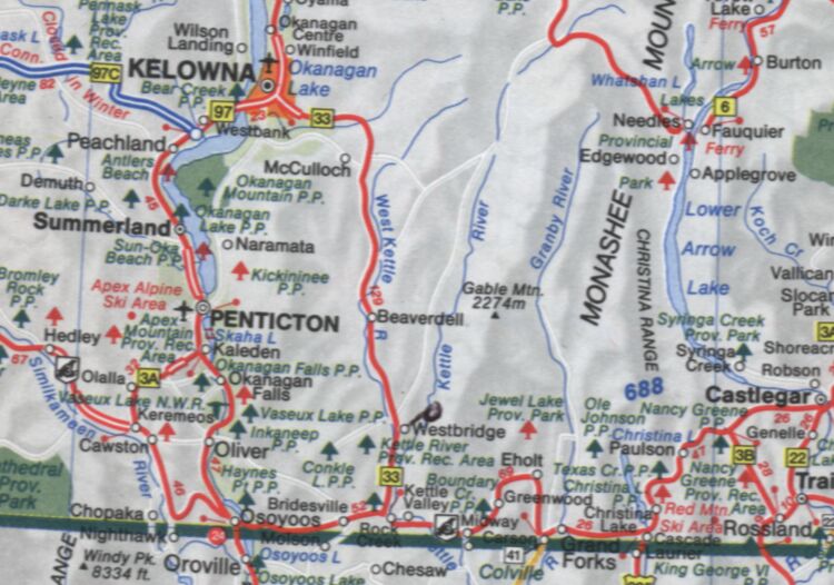
Road Map of General Area
On the map below, Westbridge is on highway 33 South of
Kelowna, down near the US border. A black circle to the
right, and you will see the words "Kettle River". We
are close to the "K" in Kettle River. About 7 kilometers up Christian Valley Road.
Pictures page 1
Pictures page 2
EMAIL
Home Page
|